
Total Roads & Asset Management System
For more than 20 years, we've worked with cities and counties across the United States & Canada to rate roads, including data collection, pavement analysis, budget preparation, and treatment recommendations.
We provide comprehensive pavement management services, including assessment and evaluation, and software to manage work, track data, prepare budgets, and recommend treatment based on selected criteria.
Public Works 1 is a subsidiary of iWorQ Systems, an industry leader in web applications for public works and community development management applications for cities and counties.
Our process helps cities and counties collect accurate information to apply timely treatments and comply with the GASB34 financial reporting requirements.
Once our team completes an onsite assessment, we digitize the information with iWorQ Pavement Management Software.
iWorQ Pavement Management Software has all the tools for inventory, data collection, inspections, data management, and updates. It tracks historical data, pavement treatment, and condition histories. Use iWorQ on any device with an internet connection. It runs on the secure AWS Gov Cloud, making it easy to access and update job information on the field.
Learn more about iWorQ Systems Management Software
The pavement management process recommended is based on the fundamental steps of asset management. The seven primary steps of asset management include:
- Inventory and Data Management
- Condition Assessment
- Asset Valuation
- Maintenance Planning
- Budgeting and Resource Allocation
- Analyze Condition and Performance Standards
- Feedback
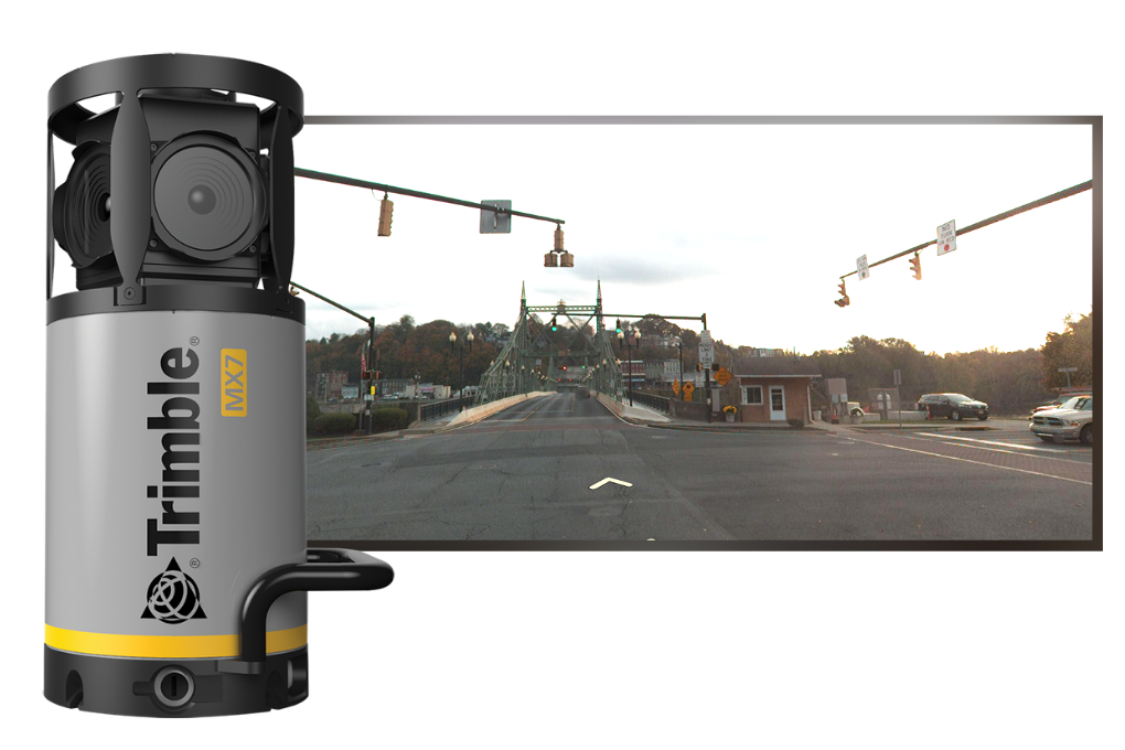
Street Level Imagery
Visualize
Manage
Disaster Recovery
For areas that are at a higher risk for FEMA natural disaster situations. Street-level imagery is a convenient and cost effective way to document assets. It provides useful information for assessing and analyzing natural disasters. See conditions of assets and roads before and after a disaster to help accelerate and justify repairs, reconstruction and help get funding from FEMA.
GPS Data Collection
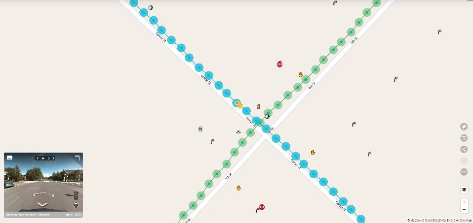
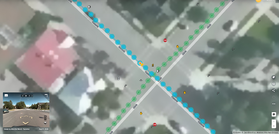
Mapping
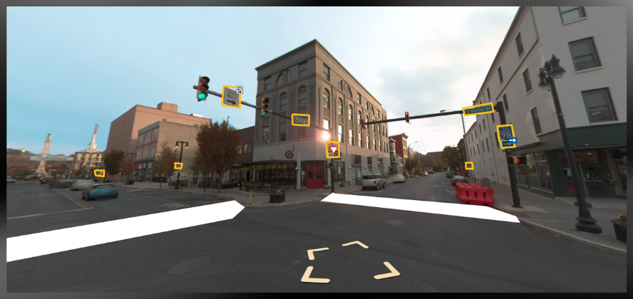
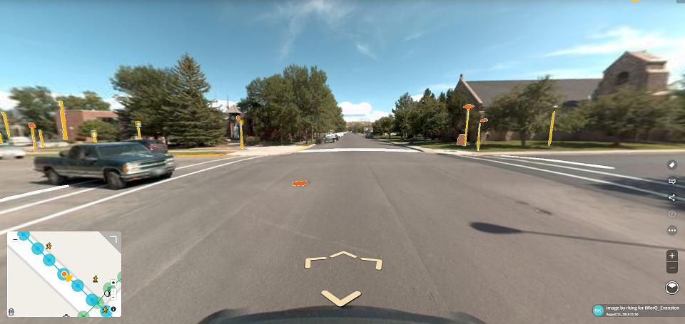
Computer Vision Technology allows you to see exactly what you are looking for. You can also narrow your search down to highlight specific types of assets.

Street level view identifies and outlines assets.
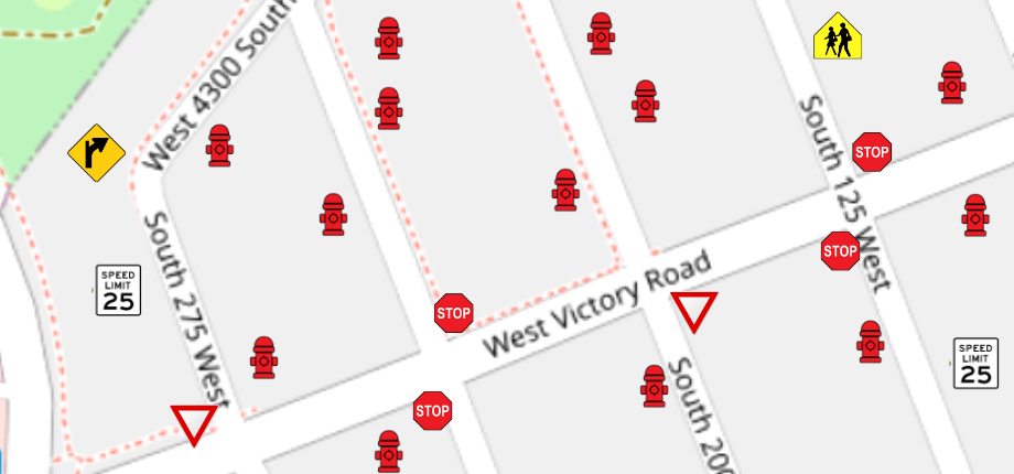

View assets on a map. This example shows signs, and hydrants in the area selected.
Featured News


Get a Quote
Fill out the contact form and we’ll be in touch soon!
Independent, third party review and assessment
Software for budget preperation and maintenance history